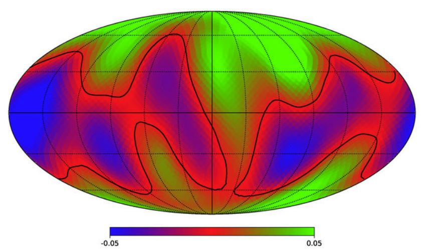
WASHINGTON, September 2 (WNM) - Researchers have constructed a contour map, published in The Astrophysical Journal Letters. They took images of the plant earth and transformed them into a way alien astronomers – if they exist - light-years away would see.
The researchers analyzed the curves of the earth and compared them with the original images, they figured out which parameters of the curves corresponded to land and cloud cover in the images. Once they knew those relationships, they picked out the parameter most closely related to land area, adjusted it for the 24-hour rotation of the Earth.
The authors write:
„Resolving spatially varying exoplanet features from single-point light curves is essential for determining whether Earth-like worlds harbor geological features and/or climate systems that influence habitability. To evaluate the feasibility and requirements of this spatial-feature resolving problem, we present an analysis of multi-wavelength single-point light curves of Earth, where it plays the role of a proxy exoplanet. Here, ~10,000 Deep Space Climate Observatory/Earth Polychromatic Imaging Camera frames collected over a two-year period were integrated over the Earth's disk to yield a spectrally dependent point source and analyzed using singular value decomposition. We found that, between the two dominant principal components (PCs), the second PC contains surface-related features of the planet, while the first PC mainly includes cloud information. We present the first two-dimensional (2D) surface map of Earth reconstructed from light curve observations without any assumptions of its spectral properties. This study serves as a baseline for reconstructing the surface features of Earth-like exoplanets in the future.“
Full research: