DURHAM, September 26 (WNM/Durham University) - More than 65,000 meltwater lakes have been discovered on the edge of the East Antarctic Ice Sheet by researchers.of Durham University.
The number of these lakes, identified using high-resolution satellite images, is more significant than previously thought.
The satellite images covered five million square kilometres of the ice sheet – the world’s largest ice mass.
Warming climate
The research shows that meltwater lakes are forming in most coastal areas of the ice sheet, suggesting that some regions could be more sensitive to the effects of a warming climate than previously thought.
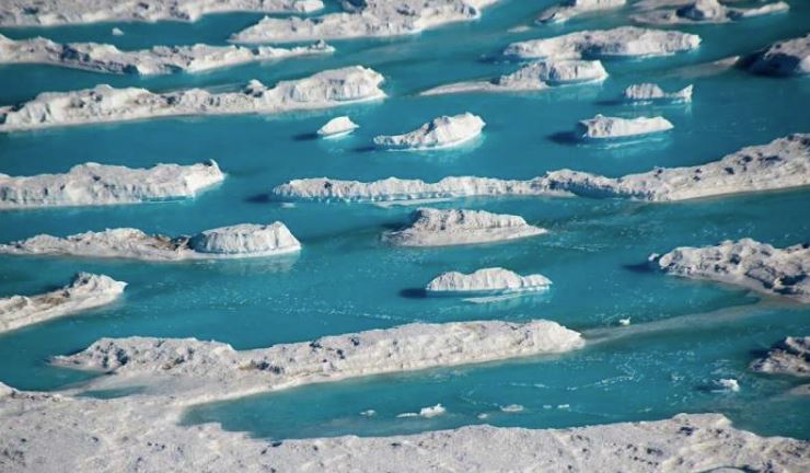
Researchers studied satellite images taken during the East Antarctic Ice Sheet’s summer melt season in January 2017 when meltwater lakes normally form.
The images showed that lakes often clustered just a few kilometres from where the ice sheet begins to float on the sea, but some can exist hundreds of kilometres inland and at heights of up to 1,000m.
Ice shelves
About 60 per cent of lakes develop on floating ice shelves, including some potentially at risk of collapse if the meltwater lakes become large enough to cause fracturing and drain through the ice.
Many of the lakes were the size of a standard swimming pool while the largest measured over 70 square kilometres.
Greenland Ice Sheet
The density of lakes seen in some regions of East Antarctica is similar to those seen on the Greenland Ice Sheet and on the Antarctic Peninsula – areas which are generally viewed as being much warmer.
The findings allow researchers to see where lakes are forming in high numbers due to surface melting and which parts of the East Antarctic Ice Sheet might be most vulnerable to climate change.
Full study: https://www.dur.ac.uk/research/news/item/?itemno=39726